
In critical emergencies—such as natural disasters, active fires, medical crises, or security incidents—every single second counts. When a crisis occurs, panic often sets in, and human instinct alone is rarely enough to navigate a complex environment safely. Responders to these exigency situations need reliable, real-time, and highly accurate data to quickly navigate convoluted indoor spaces, locate victims, and provide essential services such as medical care or fire extinguishing.
This is where advanced technology steps in to bridge the gap between confusion and safety. Indoor mapping software plays a vital, life-saving role in modern emergency response. It provides a detailed, interactive, and accurate digital representation of the built environment, enabling care workers and first responders to perform their duties far more efficiently and effectively. Emergency responders no longer have to rely on outdated paper blueprints; they need to quickly and accurately navigate indoor spaces using digital twins to locate victims, suppress hazards, or provide immediate medical care.
Historically, indoor mapping software has revolutionized the way everyday users interact with and navigate indoor spaces like malls or airports. However, emergency preparedness and safety remain the most critical, high-stakes applications of this technology. This article will analyze how integrating indoor mapping into emergency protocols provides safety by helping to save lives, protect property, and streamline crisis management.
The Challenges of Indoor Navigation in Emergency Situations
Complex indoor spaces—such as sprawling corporate office buildings, large places of worship, expansive shopping malls, multi-wing hospitals, and massive event venues—present unique and dangerous challenges during a crisis.
While outdoor environments are generally easier to navigate using traditional GPS and clear lines of sight, indoor spaces are vastly different. They feature complex architectural layouts, limited visibility (especially if power is lost or smoke fills the air), multiple vertical layers (floors and mezzanines), and a lack of clear visual cues. Furthermore, studies show that a vast majority of emergencies occur indoors, yet many facilities still rely on static, outdated floor plans. This lack of situational awareness makes it incredibly difficult for caregivers, firefighters, and police to operate swiftly.
Without a digital map, responders lose precious seconds trying to understand the layout, locate stairwells, or find critical safety assets like AEDs and fire extinguishers.
Indoor Mapping Software as the Ultimate Safety Solution
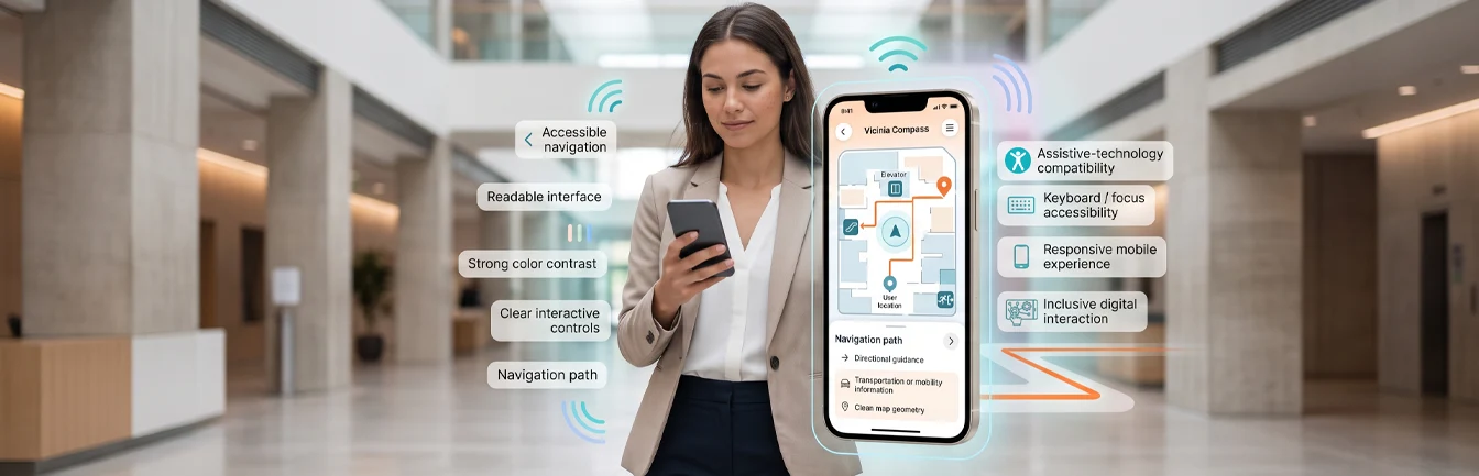
Advanced indoor mapping provides an elaborate, interactive digital representation of indoor spaces. By deploying this technology, facility managers provide caregivers and first responders with the exact spatial knowledge needed in emergencies to navigate complex buildings with ease and precision.
To be truly effective, interactive indoor maps must be deeply incorporated into a facility’s overarching emergency response systems. This integration provides critical, real-time information, such as:
1. Dynamic Emergency Exit Routes
During a fire or security threat, the standard exit might be blocked. Indoor mapping software allows administrators to push dynamic, selected emergency exit routes directly to users’ mobile devices. This guarantees that occupants and caregivers can evacuate safely, avoiding hazard zones entirely.
2. Precise Building Plans and Layouts
Digital indoor mapping provides highly accurate, multi-floor building plans and layouts. This helps emergency workers instantly understand the links between different areas in the building, identify choke points, and plan tactical entries before they even step through the front doors.
3. Identification of Critical Rooms and Assets
A robust indoor map helps people immediately identify rooms, elevators, secure stairwells, and life-saving assets. Whether someone needs to find an emergency shelter location, a fire extinguisher, or a first aid kit, the software enables both occupants and emergency workers to locate these critical areas instantly.
The Tangible Benefits for First Responders
The integration of indoor mapping software into emergency and safety response systems offers numerous life-saving benefits, including:
- Improved occupant safety: Interactive maps help building managers ensure safety by clearly identifying viable exit routes and highlighting potential hazards before they escalate.
- Drastically improved response times: By removing the guesswork from navigation, digital maps help caregivers and first responders locate the exact site of emergencies faster, ultimately saving lives and reducing critical response delays.
- Increased situational awareness: A digital twin of the building supports emergency dispatchers and on-site workers in making informed, data-driven decisions regarding resource allocation and evacuation management.
Application to Real-World Crisis Situations
First responders and progressive facility managers have already started using digital indoor mapping in severe emergency scenarios. Some of the most impactful use cases include:
- Search and rescue operations: Digital maps assist emergency workers in tracking cleared areas and locating missing persons trapped in complex indoor environments following structural collapses or natural disasters.
- Fire response and suppression: Integrated maps help firefighters navigate smoke-filled, zero-visibility buildings, locate trapped victims, and identify structural vulnerabilities or hazardous material storage areas.
- Medical emergencies: When someone suffers cardiac arrest in a massive stadium or hospital wing, the software helps paramedics locate the exact coordinates of the patient and the nearest automated external defibrillator (AED), allowing them to provide medical care in record time.
Preparing Your Facility for the Future
Indoor mapping software plays an undeniably important role in emergency response, providing emergency workers with the reliable, accurate, and real-time information necessary to navigate complex indoor spaces safely.
Integrating this software with existing emergency response systems helps organizations vastly improve safety protocols, enhance situational awareness, and protect their occupants. The need for the application of indoor mapping in public safety will only continue to grow as the technology—such as live sensor integration and real-time tracking—evolves.
If you are a facility manager looking to upgrade your safety infrastructure and provide peace of mind to your occupants, contact Vicinia today to book a demo and learn how our digital twin solutions can safeguard your building.