A unified mapping platform supporting navigation, wayfinding, and engagement across indoor and outdoor spaces.
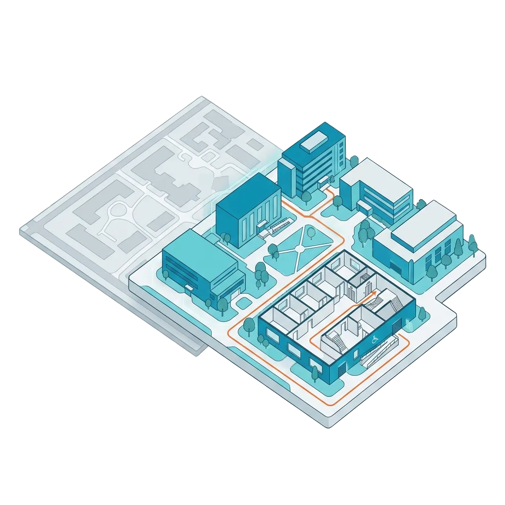
Vicinia Maps is a digital mapping platform built on a digital twin of physical environments, enabling organizations to represent, manage, and navigate complex spaces accurately. By creating a structured digital twin of buildings, campuses, and outdoor areas, Vicinia Maps supports both indoor and outdoor navigation while maintaining a single source of spatial truth across the platform.
The modular architecture allows teams to deploy the right mapping experience for their environment—indoor or campus—while managing data, content, and analytics through one unified system.
Organizations rarely operate in a single type of space. Vicinia Maps brings indoor and outdoor mapping together under one platform—so navigation, content, accessibility, and analytics remain consistent as users move between buildings and across campuses.
One platform for indoor and outdoor mapping
Shared data, content, and analytics
Consistent user experience across environments
Scalable architecture supporting future expansion
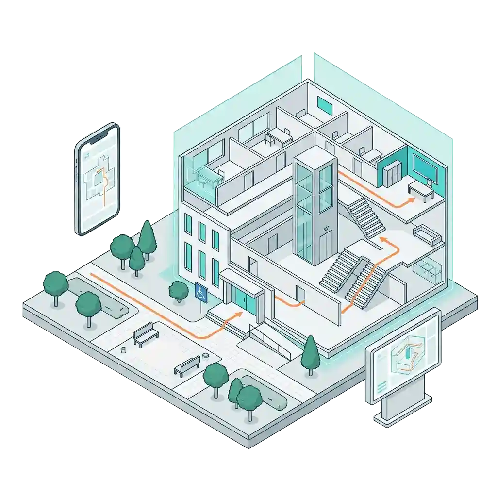
Interactive indoor maps enabling navigation, accessibility, and spatial understanding inside complex buildings.
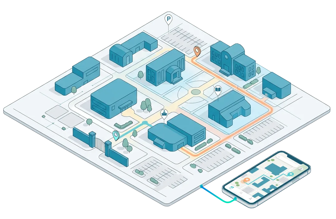
Outdoor digital maps supporting wayfinding, orientation, and visitor engagement across large campuses and destinations.
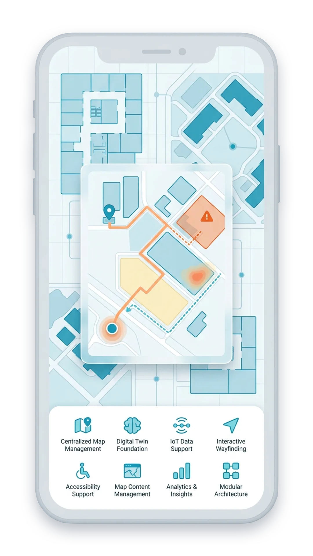
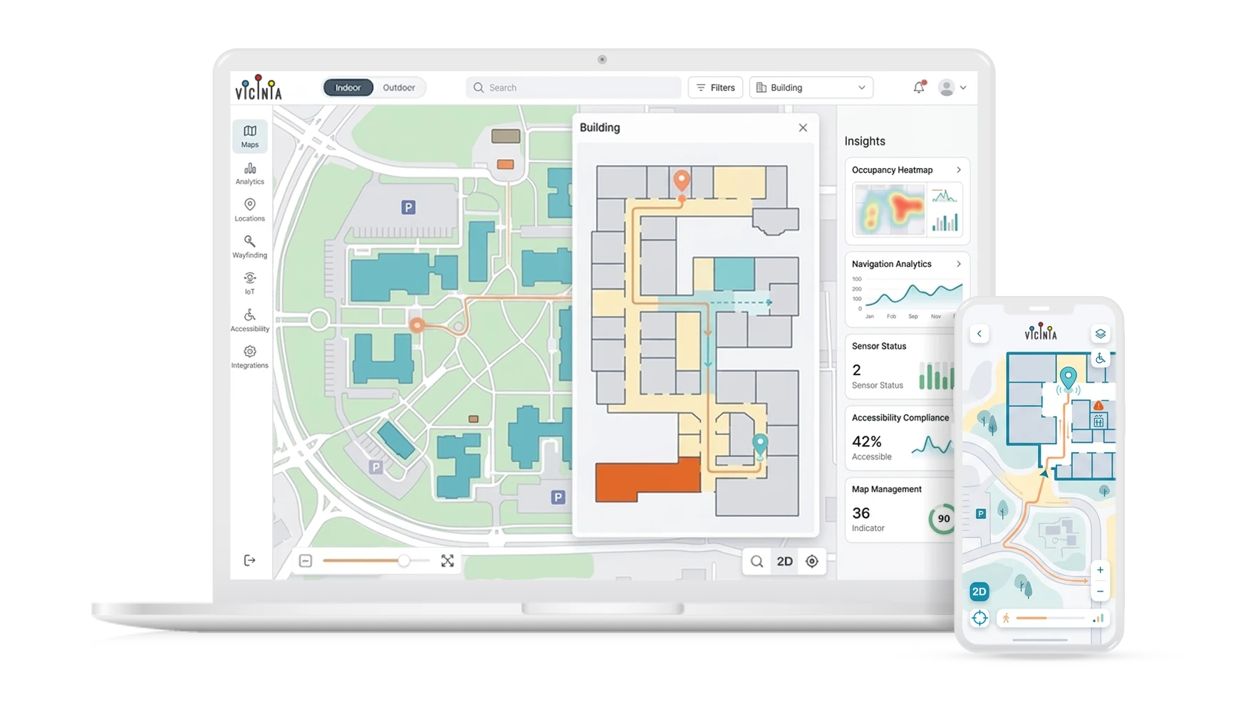
Centralized Map Management
Manage indoor and outdoor maps from one platform
Digital Twin Foundation
Spatial digital twin representing buildings, assets, and infrastructure
IoT Data Support
Ingests and visualizes IoT and sensor-based spatial data
Interactive Wayfinding
Enable clear routing and navigation experiences
Accessibility Support
Deliver ADA-aware mapping and route guidance
Map Content Management
Update locations, labels, and points of interest
Analytics & Insights
Understand map usage and navigation behavior
Scalable Deployment
Deploy only the mapping areas and capabilities you need

Vicinia Maps integrates seamlessly with other Vicinia solutions and existing enterprise systems—allowing organizations to connect spatial data, content, and analytics across their digital ecosystem.
Kiosks and digital signage
Tours and visitor engagement tools
Analytics and reporting platforms
CRM and CMS systems
Designed for flexibility, Vicinia Maps can be deployed as a full solution or consumed programmatically through SDKs—supporting custom workflows, partner integrations, and white-label applications.
Embed Vicinia Maps into custom web or mobile apps
Integrate spatial data with enterprise systems (CMS, CRM, analytics platforms)
Power partner solutions and white-label experiences using map APIs
Extend mapping capabilities through SDK-based customization


Space management, utilization tracking, availability, and booking across physical environments
Vicinia Maps integrates seamlessly with other Vicinia solutions and existing enterprise systems—allowing organizations to connect spatial data, content, and analytics across their digital ecosystem.