Provides campus parking maps with EV, ADA, and shuttle-linked routing to academic buildings.

Smart Parking Availability: Why It Matters and How
The struggle to deliver seamless parking is on the rise,...
Read More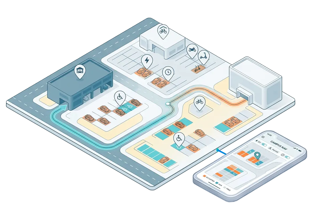
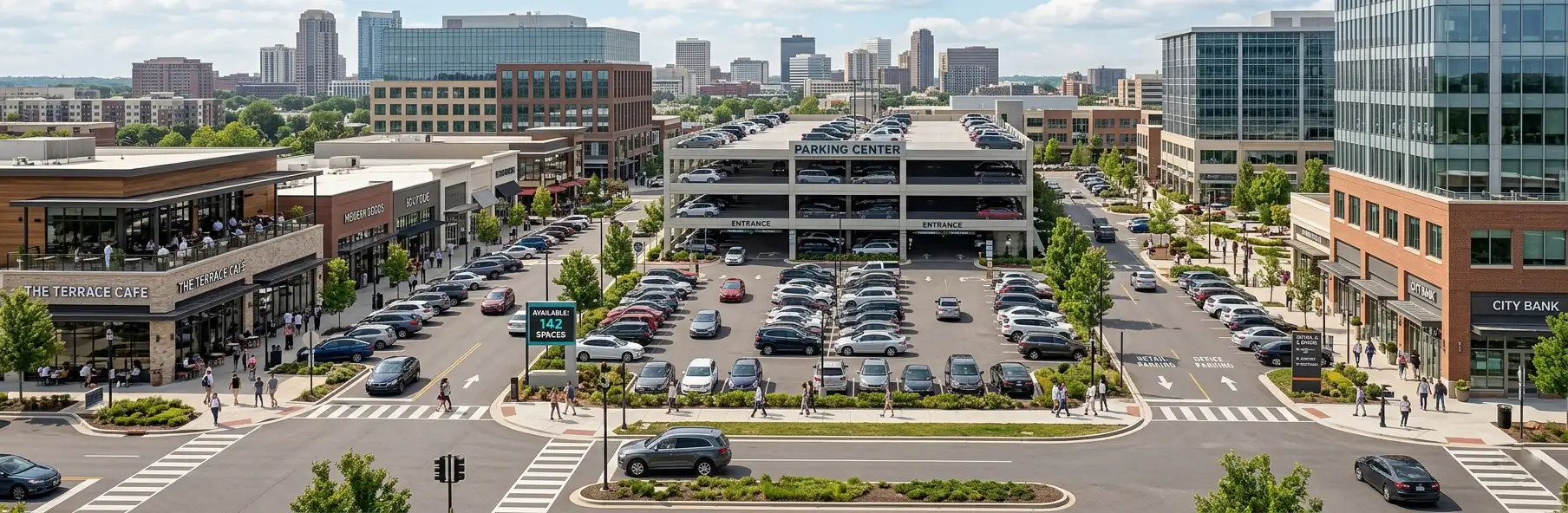
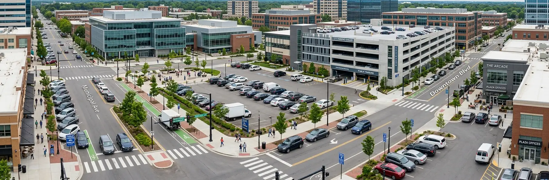
Vicinia Parking Mapping & Wayfinding delivers high-fidelity parking maps that combine GIS precision, live occupancy, and outdoor-to-indoor parking navigation. Drivers can toggle EV, accessibility, or permit zones, while operators connect maps to Vicinia Parking Management, Vicinia Transport, and partner systems for fully integrated parking and mobility experiences.


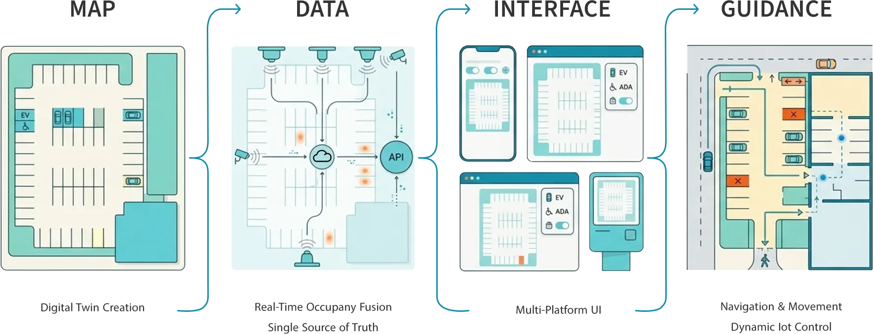
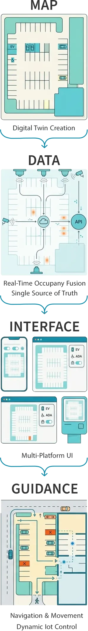
High-Fidelity Parking Maps
Build parking maps with stall-level geometry and annotations
Layered Parking Views
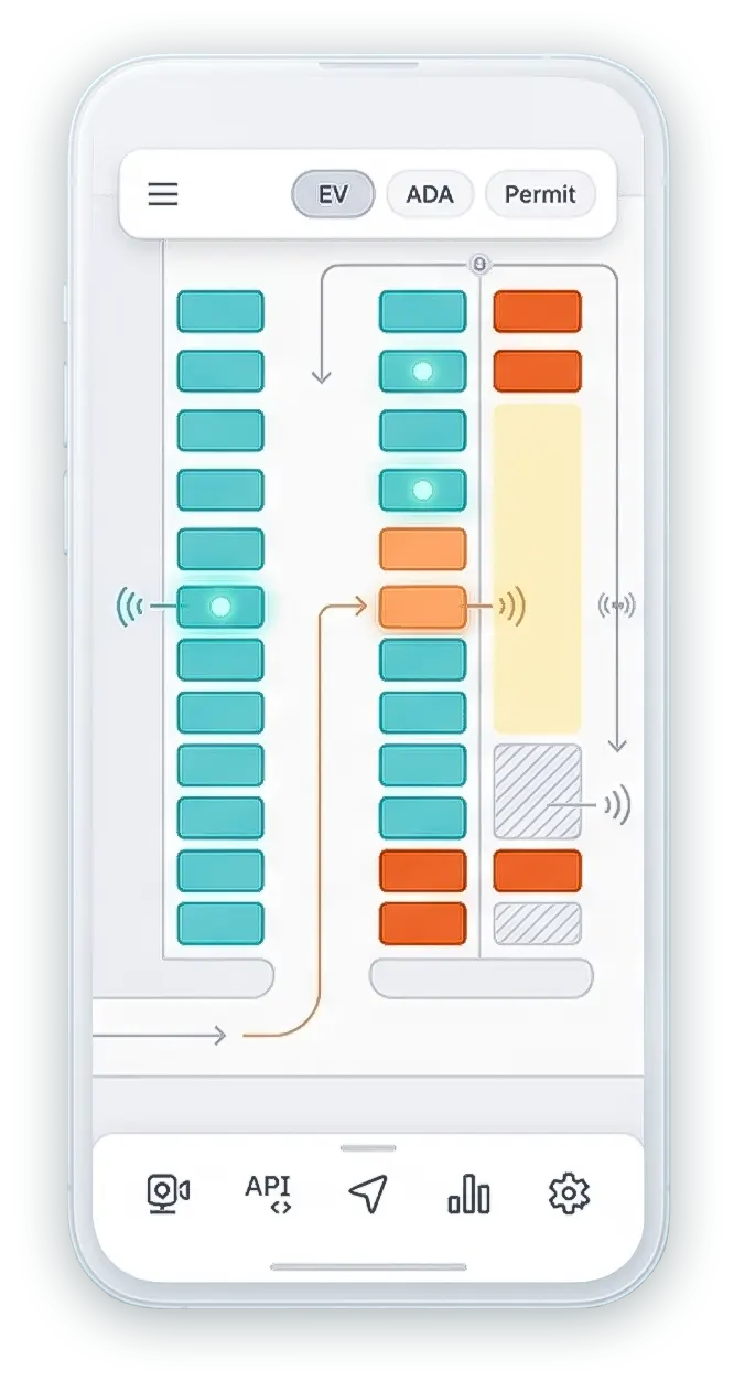
Let users toggle and visualize EV, ADA, permits on each parking map
Real-Time Occupancy Fusion
Combine sensors and AI cameras to update parking lot maps instantly
Integrated Wayfinding Signage
Sync digital parking navigation with VMS and aisle-level indicators
Personalized Permit Routing
Route users to valid zones and reserved parking garage maps
Predictive Parking Guidance
Suggest best lots using patterns, arrivals, and parking navigation
Indoor Blue-Dot Navigation
Extend parking garage wayfinding indoors with BLE beacons and IPS
Open APIs & SDKs Dynamic Lot Control
Embed interactive parking maps into mobile, web, and kiosks. Reflect closures for full, maintenance, or incident states instantly on maps

Deliver differentiated parking wayfinding with EV, ADA, and permit-aware routing from curb to door

Model every parking garage map and parking lot map across large campuses and cities.

Consolidate real-time parking space inventory into one trusted, analytics-ready platform.

Reduce circling, manual updates, and support calls with integrated parking navigation tools.
Reduction in average search time using AI-enhanced parking navigation and real-time maps.
Increase in space utilization by aligning parking space inventory with demand patterns.
Shorter entry/exit waits through integrated VMS and digital parking wayfinding.
Higher satisfaction with mobile parking maps and blue-dot wayfinding experiences.
Fuse high-fidelity parking maps with real-time data, signage, and indoor positioning for seamless journeys.

“With Vicinia Parking Mapping & Wayfinding, drivers stop circling, see exactly which lots suit them, and even navigate indoors to their reserved or remembered parking spot.”
Open Architecture
Connects parking maps with Vicinia Maps, Ways, Transport, and Indoor Positioning.
Data Standards
Supports GIS, CAD, Esri, sensor, and AI camera data for parking maps.
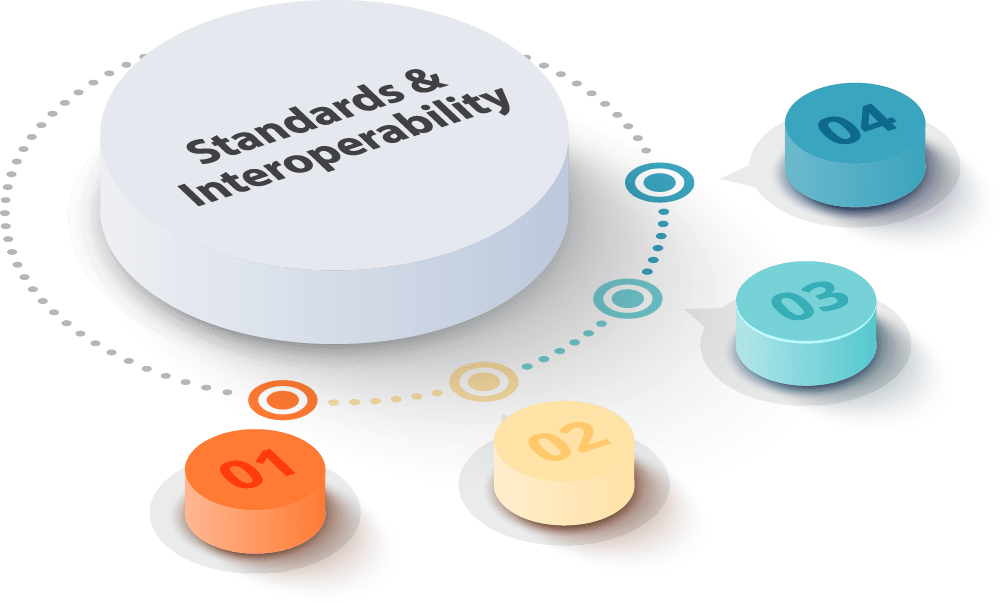
System Integration
Aggregates PARCS, gate, payment, and guidance vendors into one parking space inventory API.
SDKs & Embeds
Offers web and mobile SDKs to embed parking maps into existing enterprise apps and portals.
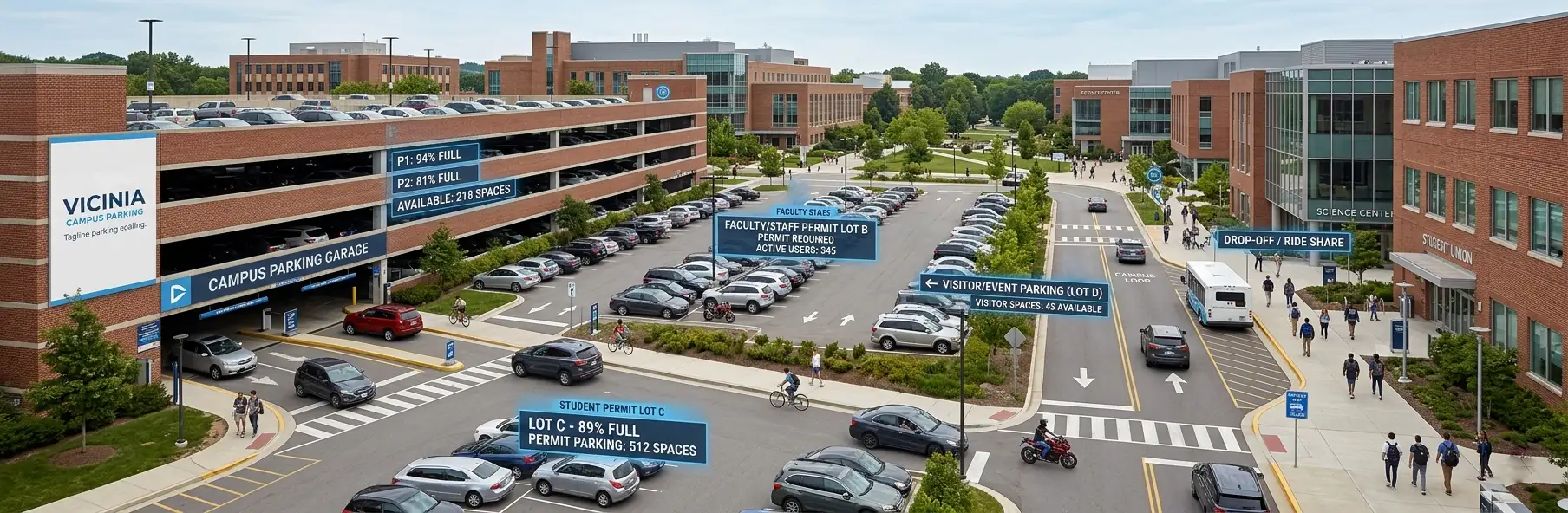
Provides campus parking maps with EV, ADA, and shuttle-linked routing to academic buildings.
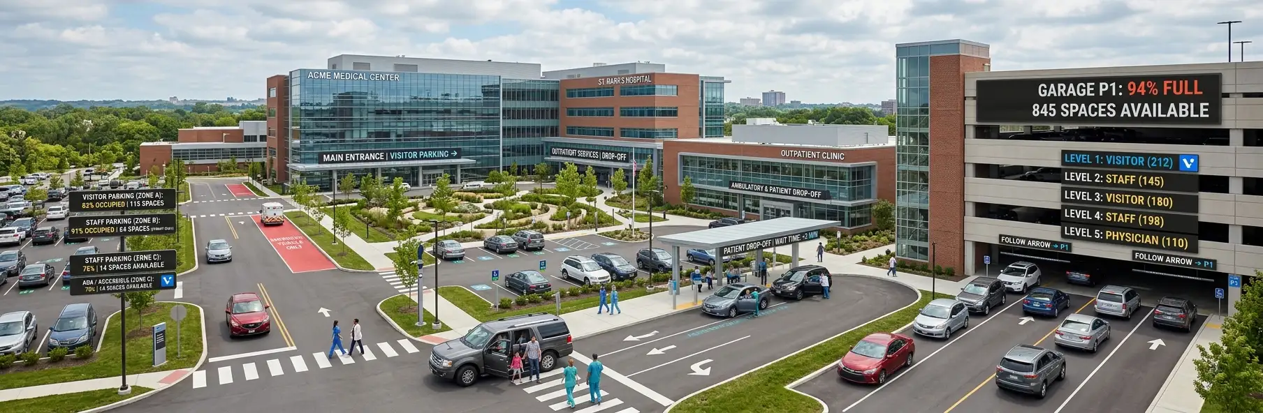
Uses parking garage maps and blue-dot indoor guidance to reduce patient and visitor anxiety.
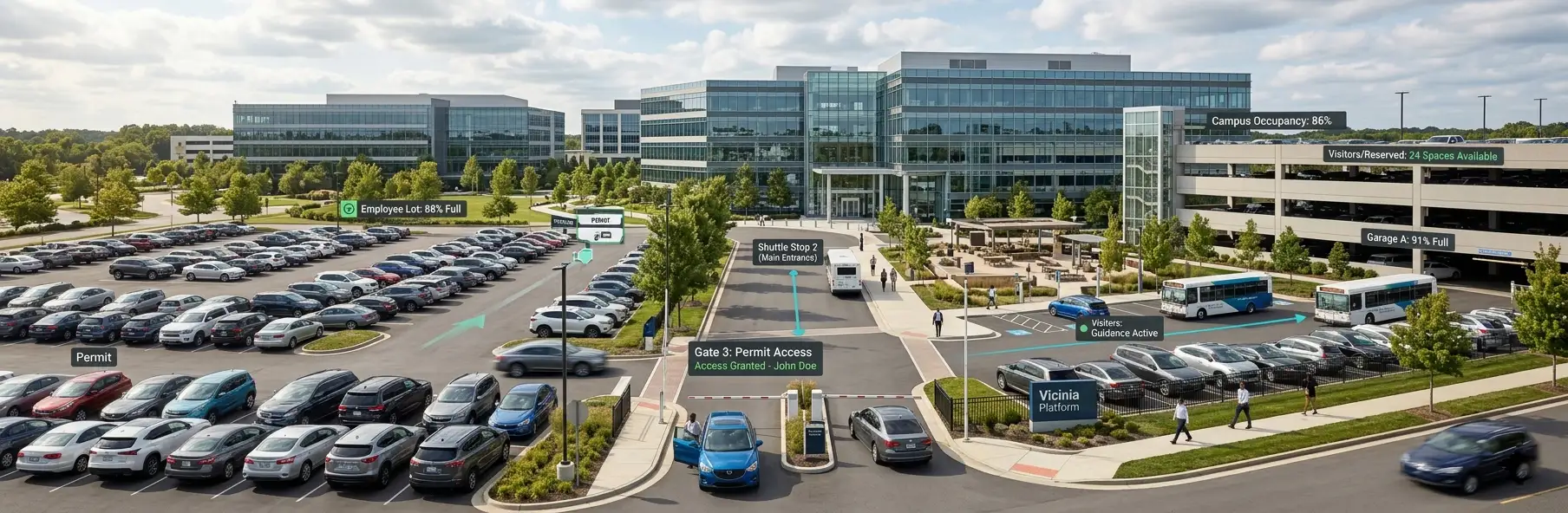
Unifies parking lot maps and permit zones, routing staff to valid, less congested facilities.
Publishes event parking map layers and directs visitors to the closest entrances and amenities.
Maintains a city parking map that links park-and-ride, EV, and transit hubs.

It replaces static PDFs with high-fidelity parking maps that show live occupancy, EV and ADA layers, and integrated outdoor-to-indoor parking navigation experiences.
Yes. Users can toggle layers on each parking map to view only eligible EV, ADA, visitor, or permit-based parking areas.
The platform fuses sensor data, gate counts, and AI camera insights to keep parking lot maps synchronized with real-time parking space inventory.
Vicinia combines parking garage wayfinding, BLE beacons, indoor positioning, and signage to guide drivers and pedestrians through complex, GPS-poor structures.
Yes. Permit-aware parking navigation automatically routes users to valid zones, including dedicated or reserved spaces, based on rules from your parking systems.
It uses predictive demand, VMS signage, and dynamic parking wayfinding to direct arrivals to the best lots before congestion builds.
Absolutely. Web and mobile SDKs let you embed interactive parking maps and guidance into your apps, portals, and kiosks.
Yes. With indoor positioning, users can pin their stall via QR or blue-dot, then navigate back using parking garage wayfinding.
Vicinia Transport links parking navigation with shuttle routes and multimodal options so arrivals are guided to the right lot for their destination.
You can allocate dedicated event parking map and setup tailored restrictions, pricing, and routing for each event type and schedule.

Asset tracking and real‑time location systems enabling visibility, status, and movement of assets.

Digital interactive maps enabling navigation, wayfinding, and spatial understanding across indoor and outdoor environments.

Interactive digital signage and wayfinding delivered through touch kiosks and digital displays

Wayfinding and routing software guiding people efficiently across indoor and outdoor environments.
The struggle to deliver seamless parking is on the rise,...
Read MoreDoes your parking business collect data? You might be sitting...
Read MoreTennis isn’t the only attraction at Roland-Garros. People want to...
Read More